

Seattle weather: Cooler with morning showers Thursday
Seattle - Cool and showery weather will persist over Western Washington Thursday as a low pressure system passes through the region.
Thursday will bring mainly morning showers, with a drier afternoon for most spots. If you are caught in the Puget Sound Convergence Zone, showers could linger well into the afternoon. That area of rain looks to set up near the Snohomish County/King County line.
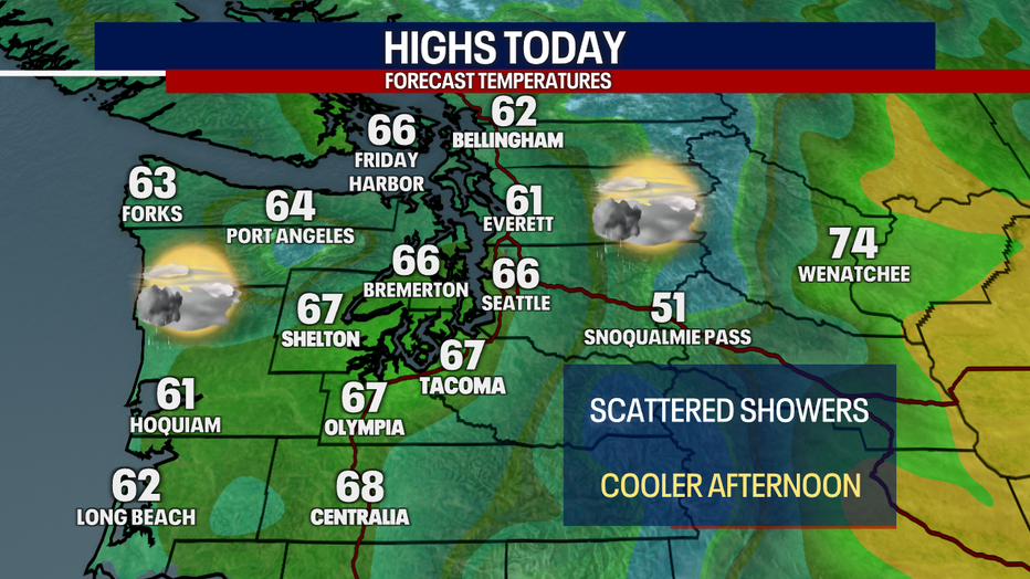
A map showing the high temperatures forecast for Thursday in Western Washington. (FOX 13 Seattle)
Temperatures will top out about 5 to 7 degrees below average, only making it into the mid 60s.
Fire risk levels will be elevated Thursday as breezy winds continue east of the Cascades. Thunderstorms are also possible in Eastern Washington.
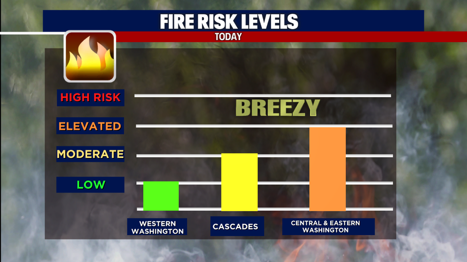
A graph showing the risk levels for Western Washington, the Cascades, and Central/Eastern Washington. (FOX 13 Seattle)
A weak ridge of high pressure will move into the Pacific Northwest Friday, bringing a pattern of morning clouds and afternoon sunshine. Temperatures will be back into the 70s.
The next chance of rain arrives Sunday and Monday. The best chance for rain will be on the coast and in the higher elevations. Any accumulations in the lowlands will likely be light.
A ridge of high pressure will settle in over the Pacific Northwest by mid-next week. That will usher in more sunshine and temps back in the mid to upper 70s.
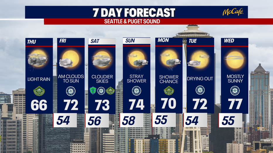
A very pleasant 7 day forecast for Seattle as we wrap up June. (FOX 13 Seattle)